Tag Archives: Cycling

The Jungle Trek

Still Aisling, still writing from Cusco, but we’ve just come back from a three-day adventure through the jungles of Peru ending at Machu Picchu. Mind = blown.

Many people opt to do the hard-going traditional Incan and Salkantay treks leading to the base of the mountain, four- and five-day hikes that show you old Incan sites of residence and worship. We decided to do something called the Jungle Trek which involved much less walking and a few more very fun activities along the way, such as rafting, downhill biking and zip-lining before climbing Machu Picchu on the last morning. Lemme tell y’all about it!

Day 1: Biking and rafting

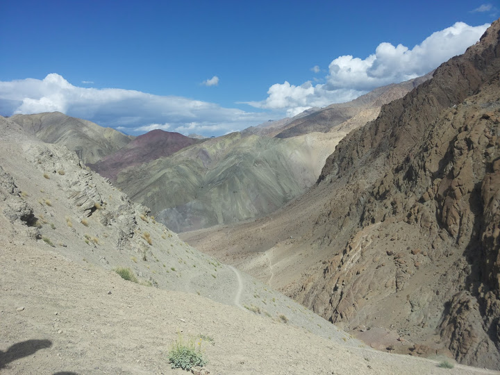
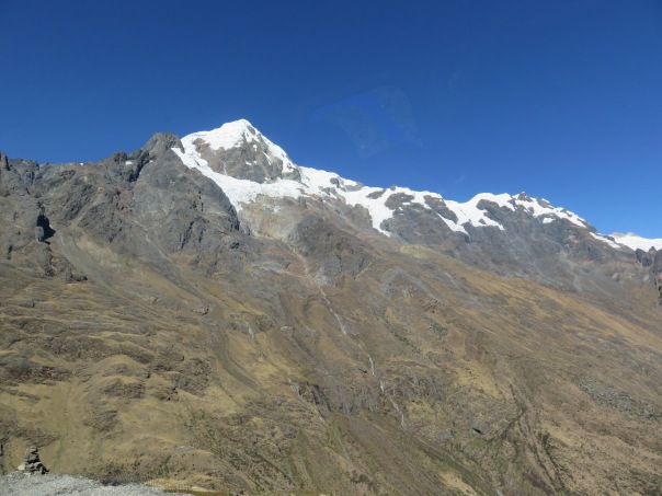
We got up early on the morning of the first day and were picked up by one of the guys from Loki travel who run this whole show. The van took us on a journey across and up the mountains where we rose to 4,200m to the top of Abra Malaga, among glacier-topped peaks, and were given our bikes.

Said glacier-topped peaks…

img_0237

Then began the great descent! 2000m straight down over three hours. The Loki guys were pretty good, giving us safety equipment and frequently stopping to make sure we were OK. The roads were smooth and mostly unoccupied but winding and it took me a while to learn to love the scoot around the sharper turns, but it’s great fun, as long as you don’t mind the constant reminders of how high up you are when you’re on the right side of the road to see the sheer drop below you.The curves and direction of descent were important: because Peruvians drive on the right hand side, curving on a switchback heading to the right can mean encountering a (usually bombing it) vehicle on the turn, so if you’re going too fast you get mashed into the vehicle. Going too fast on a switchback to the left however can result in you flying out into space with only thin air below you. Shlow down, Tommy! 

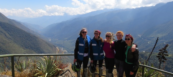
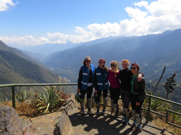
This is the crew in all our safety-equipped glory:

IMG_0247.JPG

Rafting took place in the afternoon in Santa Maria.

Screen Shot 2016-09-22 at 13.11.38.png

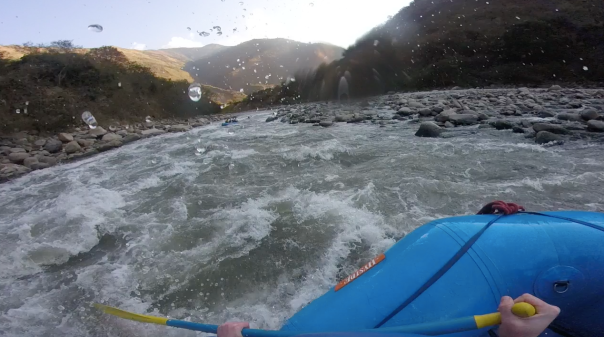
We practised the usual commands of “forward”, “back” and “get down!” on the less-white-water parts of the river where we started, initially screaming in pleasure/terror at the bounces in the water that two hours later we met with yawning faces as the speed and turbulence increased, all the while knocking our paddles together with a team mantra of “Sexy llamas!” to celebrate particularly hard-won survivals. A lack of contact lenses and inability to hear the commands from our leader in the back of the boat over the roar of the river had Holly paddling happily face-first into a cliff wall halfway through, which I was still in tears laughing about as we neared the end. Here’s a screenshot of us celebrating our teamwork!
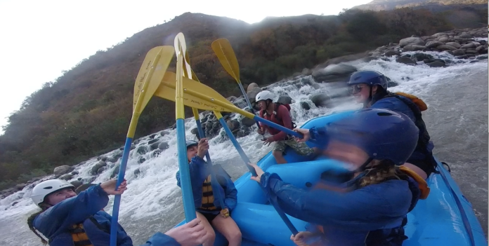
 

screen-shot-2016-09-19-at-18-16-32

Sexy llamas indeed!

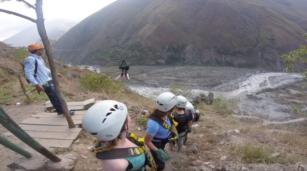
Day 2: Zip-lining and hiking: 


We stayed at a pretty nice hostel by the river geared for all these activities overnight and met the biggest, blackest bug I’ve ever seen, slept in the comfiest beds of our travels so far and had a rather substantial breakfast the next morning which we all threatened to throw up as we we saw the heights we were going to be zip-lining over. In fact, a whole multitude of bodily fluids threatened to make an appearance. Don’t tell me you wouldn’t have pissed yourself.


Screen Shot 2016-09-22 at 13.04.20.png

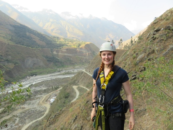
Also check me out in my super-attractive zip-lining gear!

img_0268

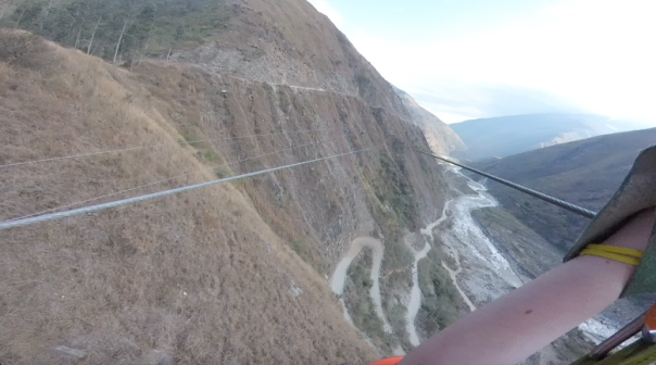
Once you get over the initial fear and actually succeed in throwing yourself over the side of a 1000m cliff, the experience is in fact rather enjoyable. I’d never been zip-lining before. After this I’m not sure I should; nothing’s going to top the experience! It’s the speed, the rush, the sound of your pulley accelerating on the wire, shooting over a deadly but beautiful drop to the adjacent mountain – it’s as close as I’ll ever get to flying. Pretty damn good.

We tried it backwards and upside down too!

Screen Shot 2016-09-22 at 13.06.20.png

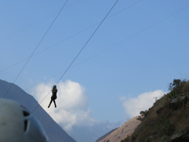
The little white blob apparently hanging in mid-air is me. They call this one the Spider-Man, one of many different positions they encourage you to try on the wire, not to mention all the various llama ones (“sexy llama” was in there too). I was screaming at the top of my lungs in this, even though I like to think in the photo I convey a cool, collected exterior.

I’d love to put in a video of Holly flying over the valleys – WordPress unfortunately doesn’t let me do this, but she got some incredible GoPro footage of what it looks like to soar between two mountains. On the ground, I managed to document some of the others as they shout through the air. I won’t tell you which of us this is, but for friends who are reading, you might be able to guess. 😉

IMG_0265.JPG

After the zip-lining, three hours of walking ensued. This was where things got tricky. One of our number hadn’t been coping so well with the altitude and this is where her altitude sickness started to get very, very bad. Incredibly she managed to finish the hike – easy for the rest of us as it was flat along a train track used to get from Aguas Calientes at the foot of Machu Picchu to Ollantaytambo – but not the easiest if you also happen to be suffering from pounding headaches, nausea, stomach pain and dizziness. She says she doesn’t remember most of the walk. I can’t believe she did it at all.

When we got to Aguas Calientes, said member of our group went straight to bed, couldn’t be roused for food and though it brought her to tears denying it, was in no shape for the tough climb the next morning. It was a distressing time. A doctor was called in that night to make the diagnosis and prescribe medication – a double-dose of our own altitude-combating drugs plus anti-emetics for her stomach – and we discussed what to do. Our friend in need was not going to make it up the mountain.

…and there I will leave you on a cliff-hanger. What happened next deserves a post of its own, so I’ll leave you in suspense and you can catch up when the next post comes along.

Hasta próxima!


Photos from The Himalayas

We used today to recover after the hike. I therefore don’t have THAT many interesting things to say, so I’ll use the opportunity to put up the pictures from everything I’ve missed – I promise they’ll be spectacular, which has nothing to do with my photography!

So I guess I’ll start with when we were flying into Leh first of all; t was pretty spectacular. This was the first of the snow we saw from above…

First snow from the airplane

It soon became this.

Lots of slow from the airplane!

Then there’s Leh itself. This is the view from our rooftop; I took the photo the first evening we were there. From the terrace you can see all the buildings, a spectacularly close vie wot Leh Palace and on the other side, snow-capped Himalayas in the background. It’s a pretty special sight.

Gold dust on Leh

This was our first sunset in Leh. “Sunset” is a bit of a loose term because in the Himalayas, just because the sun’s out of sight for you doesn’t mean it is anywhere else. It’s probably just the mountain you’re standing under.

Sunset over Leh

Even after that when we went for dinner, it took ages for it to go down on the mountain north of the town.

Leh sunset

Now, moving on… I guess the next major photo fest I have is from our trek through the Himalayas – we didn’t really take too many when we were rafting on the Zanskar, unfortunately, we were too busy battling for our lives, but I can show you photos from the Hike. I took PLENTY of time to take photos – every one was an opportunity for a rest! This photo was from the monastery where we began. It’s massive golden Buddha.

2014 - 39

It’s pretty damn big. Also, look at how blue the sky is – it’s so, so clear in Leh. After the monastery we went to the school where we had tea with the monks. Remember afterwards I was telling you that they all went into a room to chant? This is them.The kid at the front on the left was unbearably cute; he’d left his shoes on by mistake and didn’t know any of the words. They were really belting out the tunes…

Monks chanting

I guess after that most of what we saw on the hike looked something like this.

Himalayas

I have a bunch of images like that that would look exactly the same to you so I guess there’s not really much point in sharing them, but from that one I hope you can appreciate the scenery. It’s pretty damn amazing. It really took us by surprise how desert-like the whole thing is – it’s super-dry. The earth is drained of all moisture, and nothing survives except the hardiest of scrub. Apart from that, all there is is rocks and dust.

Remember on the second day of the trek I told you me and Lucy did a really idiotic climb up to the road when we were looking for an easier path? This was the view from the top. If you look really hard, you can see the tiny little ribbon of white at the bottom that is the trail we climbed up from. It was madness! We had to stop every ten seconds or less to catch our breath! We felt on top of the world though when we finally got there; it was a great (if slightly sick) feeling!

The idiot's climb

This was the lady of the second home stay we stayed in before the final trek, and beside her is Stanzin, our guide. Her kitchen was amazing; you can see all the silver pots I was telling you about behind her. Their hospitality was class! And their cat was cool.

In the kitchen

After that day we went across that ridiculous pass – it was when we were debating whether we could do it or not. I was fully decided on taking the taxi and then in a moment of madness I said I do it. This is it here…

Looking across the pass

The foreground was the bit going down. The path on the right below was the one we took across, and then on the far side you can just about make out the path we went up. If it looks like it’s going straight up, you’re looking at the right one. It was almost impossible, but we managed in the end! Oh, and by the way, these were the backpacks we were carrying up.

Backpack

Here was the view down from halfway…

Going up the really really big hill!

And from the top. That bunting was the end-of-the-marathon ribbon.

Mountians and the Bunting

The inevitable panorama…

3860 panorama

And the road on from there at the top…

Trail beyond the big climb

God, that was one tough hill!

When we got to the village at the end of the trek there were walnut trees all around. For those of you who don’t know, THIS is a walnut. they’re kind of like chestnuts.

Walnut tree

Then you pick them off and break them open. This one wasn’t ripe; it’s the white bit inside.

Open Walnut

And that was the end of the trek. Next I guess I’ll show you the photos from the cycle, them oat spectacular of which is the one from the top. We were 5600 metres in the air, good God it was cold. It’s really, really high up. It was snowing, we were ill-equipped for the temperature and there was NO air up there; we could hardly breathe – it was amazing! The highest motor able road in the world, don’t you know.

Khardungla

My Google+ made this charming little picture of my team mates, looking very cold.

20140825_133843-SNOW

And THIS is what it looked like when we got to the bottom. Quite a stark change! It was much more pleasant down there – warmer, more air – pretty stunning views as well.

At the base

These were the mountains behind us. It was a pretty amazing all-round view.

Desert Himalayas

View over Gangla

And this was me, in all my cycling glory. You don’t have to tell me how fabulous I look. I already know.

BiKing Down!

Once again, the inevitable panorama.

Bottom of the cycle panorama

So yeah, that was our adventures through the Himalayas! Hope you liked the pictures, sorry I couldn’t put them up until now. I’ll be back soon for the actually post about the cycle and then our adventures in Kerala, which we’re enjoying at the moment. It’s pretty incredible; I’ve a lot of stories for you and hopefully now enough time to tell you about them!

Talk soon!